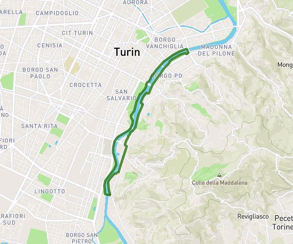
This walking route covers 5.63mi starting from Torino, Turin. The walk is a loop trail and returns to the trailhead. This walk is rated as hard, plan for about 2h1m to complete it. The route has an elevation gain of 577ft and an elevation loss of 587ft.
Ponte umberto
Route details
21:30/mi
Pace
494 kcal
Calories burned
Loop trail
Route type
709ft
Min altitude
774ft
Max altitude
Route profile
577ft
Elevation gain
587ft
Elevation loss
709ft
Min altitude
774ft
Max altitude
How to get there
Trailhead: Corso Moncalieri 305, 10133 Torino Turin, Italy
GPS coordinates of the trailhead: 45.032049, 7.679173 / 45°1'55'' N, 7°40'45'' E