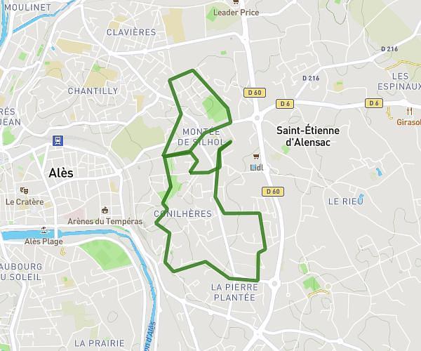
This walking route covers 2.331mi starting from Alès, Gard. The walk is a loop trail and returns to the trailhead. This walk is rated as easy, plan for about 56m16s to complete it. The route has an elevation gain of 184ft and an elevation loss of 184ft.
11 mai
Route details
24:08/mi
Pace
230 kcal
Calories burned
Loop trail
Route type
489ft
Min altitude
587ft
Max altitude
Route profile
184ft
Elevation gain
184ft
Elevation loss
489ft
Min altitude
587ft
Max altitude
How to get there
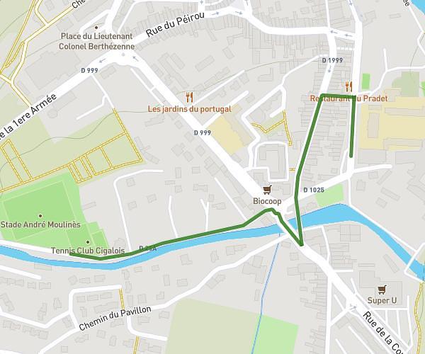
Trailhead: 586 Avenue Jean Philippe Rameau, 30100 Alès, France
GPS coordinates of the trailhead: 44.133194, 4.10986 / 44°7'59'' N, 4°6'35'' E