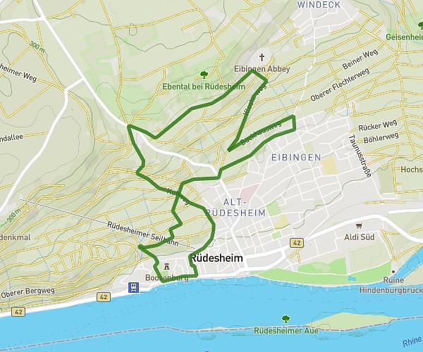
This hiking trail covers 4.434mi starting from Rüdesheim am Rhein, Hesse. The hike does not return to the trailhead and ends near Oberstraße 11, 65385 Rüdesheim am Rhein, Germany. This hike is rated as moderate, plan for about 1h43m to complete it. The route has an elevation gain of 614ft and an elevation loss of 1316ft.
Weinwanderung Jagdschloss
Route details
2.56mph
Speed
759 kcal
Calories burned
8.2%
Avg grade
Point to point
Route type
302ft
Min altitude
1168ft
Max altitude
Steep climb
Route profile
614ft
Elevation gain
1316ft
Elevation loss
302ft
Min altitude
1168ft
Max altitude
How to get there
Trailhead: Am Niederwald 4, 65385 Rüdesheim am Rhein, Germany
GPS coordinates of the trailhead: 49.982642, 7.901984 / 49°58'57'' N, 7°54'7'' E