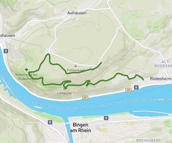
This hiking trail covers 4.117mi starting from Rüdesheim am Rhein, Hesse. The hike is a loop trail and returns to the trailhead. This hike is rated as moderate, plan for about 1h41m to complete it. The route has an elevation gain of 709ft and an elevation loss of 712ft.
Weinwanderung Kloster St. Hildegard
Route details
2.45mph
Speed
745 kcal
Calories burned
6.5%
Avg grade
Loop trail
Route type
269ft
Min altitude
814ft
Max altitude
Route profile
709ft
Elevation gain
712ft
Elevation loss
269ft
Min altitude
814ft
Max altitude
How to get there
Trailhead: Panoramaweg, 65385 Rüdesheim am Rhein, Germany
GPS coordinates of the trailhead: 49.980871, 7.92309 / 49°58'51'' N, 7°55'23'' E