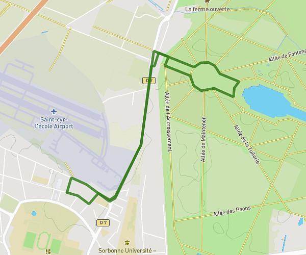
This running route covers 10.131mi starting from Guyancourt, Yvelines. The run is a loop trail and returns to the trailhead. This run is rated as hard, expect about 1h37m to complete it. The route has an elevation gain of 30ft and an elevation loss of 26ft.
Sortie longue
Route details
6.21mph
Speed
1118 kcal
Calories burned
Loop trail
Route type
525ft
Min altitude
548ft
Max altitude
Route profile
30ft
Elevation gain
26ft
Elevation loss
525ft
Min altitude
548ft
Max altitude
How to get there
Trailhead: 6 Rue Henri Matisse, 78280 Guyancourt, France
GPS coordinates of the trailhead: 48.781592, 2.055618 / 48°46'53'' N, 2°3'20'' E