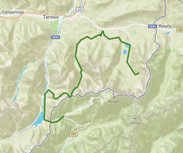
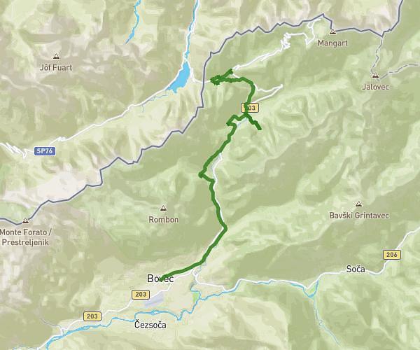
This hiking trail covers 8.865mi starting from Tarvisio, Udine. The hike does not return to the trailhead and ends near Borovška Cesta 76, 4280 Kranjska Gora, Slovenia. This hike is rated as hard, plan for about 2h51m to complete it. The route has an elevation gain of 889ft and an elevation loss of 1309ft.
BELOPEŠKA JEZERA-KRANJSKA GORA
Route details
3.11mph
Speed
1236 kcal
Calories burned
4.7%
Avg grade
Point to point
Route type
2618ft
Min altitude
3173ft
Max altitude
Route profile
889ft
Elevation gain
1309ft
Elevation loss
2618ft
Min altitude
3173ft
Max altitude
How to get there
Trailhead: Via Dei Laghi 8, 33018 Tarvisio Udine, Italy
GPS coordinates of the trailhead: 46.48042, 13.67338 / 46°28'49'' N, 13°40'24'' E