MapPlanner
15.414mi
Distance
3h6m
Duration
4.97mph
Speed
+1841ft
Elevation gain
-1837ft
Elevation loss
Strenuous
Level

Trezioux mauzun

Route details

1677 kcal
Calories burned
4.5%
Avg grade
Loop trail
Route type
1388ft
Min altitude
2008ft
Max altitude

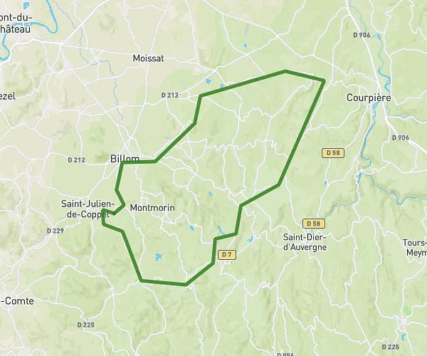
This cycling route covers 15.414mi starting from Estandeuil, Puy-de-Dôme. The ride is a loop trail and returns to the trailhead. This route is rated as strenuous, plan for about 3h6m to complete it. The route has an elevation gain of 1841ft and an elevation loss of 1837ft.

Route profile

1841ft
Elevation gain
1837ft
Elevation loss
1388ft
Min altitude
2008ft
Max altitude

How to get there

Trailhead: 654 Route Du Creux Du Loup, 63520 Estandeuil, France

GPS coordinates of the trailhead: 45.683961, 3.446284 / 45°41'2'' N, 3°26'46'' E

Caution: May Cross Private Property

This route may pass through or near private property. Always respect posted signs, obtain permission where required, and follow local trespassing laws. MapPlanner does not guarantee public access along any route.

Safety Notice

Trail and road conditions may change without notice due to weather, construction, or other factors. Always verify current conditions before heading out. You are responsible for your own safety — follow local signage, obey traffic laws, and use your best judgment on the trail.