MapPlanner
5.262mi
Distance
1h41m
Duration
3.11mph
Speed
+351ft
Elevation gain
-354ft
Elevation loss
Easy
Level

Carnaval

Route details

904 kcal
Calories burned
2.5%
Avg grade
Loop trail
Route type
262ft
Min altitude
404ft
Max altitude

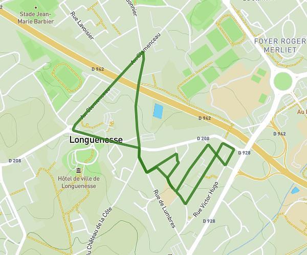
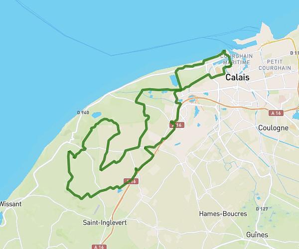
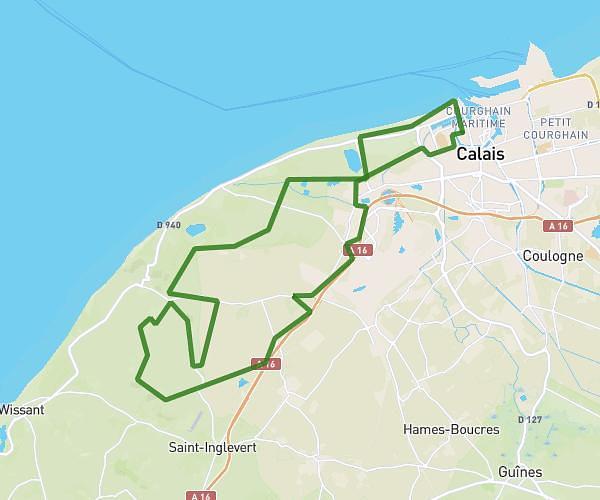
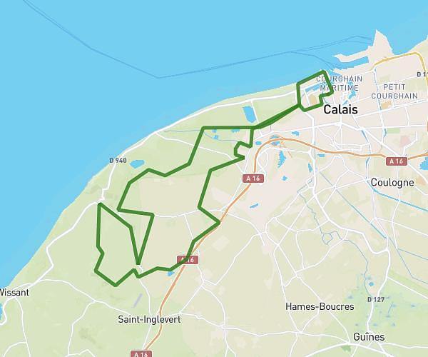
This cycling route covers 5.262mi starting from Bainghen, Pas-de-Calais. The ride is a loop trail and returns to the trailhead. This route is rated as easy, plan for about 1h41m to complete it. The route has an elevation gain of 351ft and an elevation loss of 354ft.

Route profile

351ft
Elevation gain
354ft
Elevation loss
262ft
Min altitude
404ft
Max altitude

How to get there

Trailhead: Rue De La Mairie, 62850 Bainghen

GPS coordinates of the trailhead: 50.75126, 1.90602 / 50°45'4'' N, 1°54'21'' E

Caution: May Cross Private Property

This route may pass through or near private property. Always respect posted signs, obtain permission where required, and follow local trespassing laws. MapPlanner does not guarantee public access along any route.

Safety Notice

Trail and road conditions may change without notice due to weather, construction, or other factors. Always verify current conditions before heading out. You are responsible for your own safety — follow local signage, obey traffic laws, and use your best judgment on the trail.