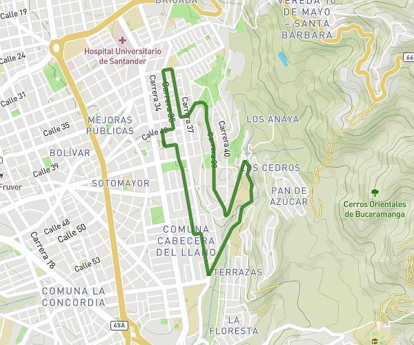
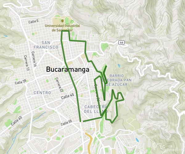
This running route covers 10.566mi starting from Bucaramanga, Santander. The run does not return to the trailhead and ends near Calle 55 28 54, 680003 Bucaramanga, Santander, Colombia. This run is rated as hard, expect about 2h to complete it. The route has an elevation gain of 1316ft and an elevation loss of 1535ft.
Domingo
Route details
5.28mph
Speed
1372 kcal
Calories burned
Point to point
Route type
3038ft
Min altitude
3507ft
Max altitude
Route profile
1316ft
Elevation gain
1535ft
Elevation loss
3038ft
Min altitude
3507ft
Max altitude
How to get there
Trailhead: Carrera 53 73 16, 680003 Bucaramanga, Santander, Colombia
GPS coordinates of the trailhead: 7.10248, -73.09907 / 7°6'8'' N, 73°5'56'' W