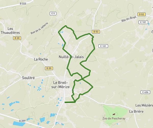
This walking route covers 4.311mi starting from Guécélard, Sarthe. The walk is a loop trail and returns to the trailhead. This walk is rated as moderate, plan for about 1h25m to complete it. The route has an elevation gain of 144ft and an elevation loss of 144ft.
Maison spay
Route details
19:42/mi
Pace
347 kcal
Calories burned
Loop trail
Route type
125ft
Min altitude
161ft
Max altitude
Route profile
144ft
Elevation gain
144ft
Elevation loss
125ft
Min altitude
161ft
Max altitude
How to get there
Trailhead: 19 Rue Du Grand Chardonneret, 72230 Guécélard, France
GPS coordinates of the trailhead: 47.897642, 0.144427 / 47°53'51'' N, 0°8'39'' E