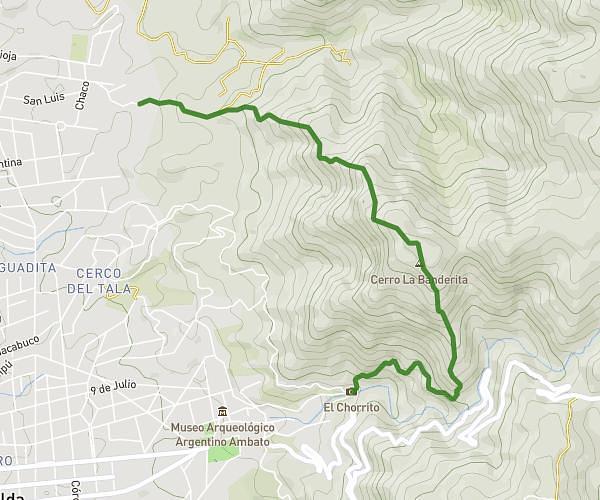
This running route covers 3.098mi starting from Capilla del Monte, Córdoba. The run does not return to the trailhead and ends near Avenida Amadeo Sabattini 1310, Capilla del Monte, Córdoba, 5184, Argentina. This run is rated as easy, expect about 26m25s to complete it. The route has an elevation gain of 505ft and an elevation loss of 3314ft.
Cerro Uritorco
Route details
7.03mph
Speed
302 kcal
Calories burned
Point to point
Route type
3484ft
Min altitude
6316ft
Max altitude
Route profile
505ft
Elevation gain
3314ft
Elevation loss
3484ft
Min altitude
6316ft
Max altitude
How to get there
Trailhead: Capilla del Monte, Córdoba, X5184, Argentina
GPS coordinates of the trailhead: -30.84528, -64.47704 / 30°50'43'' S, 64°28'37'' W