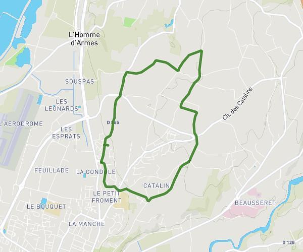
This running route covers 4.517mi starting from Saint-Symphorien-sous-Chomérac, Ardèche. The run is a loop trail and returns to the trailhead. This run is rated as easy, expect about 1h15m to complete it. The route has an elevation gain of 489ft and an elevation loss of 420ft.
Saint Symphorien sous chomerac
Route details
3.62mph
Speed
858 kcal
Calories burned
Loop trail
Route type
499ft
Min altitude
988ft
Max altitude
Route profile
489ft
Elevation gain
420ft
Elevation loss
499ft
Min altitude
988ft
Max altitude
How to get there
Trailhead: 545 Route Des Gleyziers, 07210 Saint-Symphorien-sous-Chomérac, France
GPS coordinates of the trailhead: 44.72457, 4.70848 / 44°43'28'' N, 4°42'30'' E