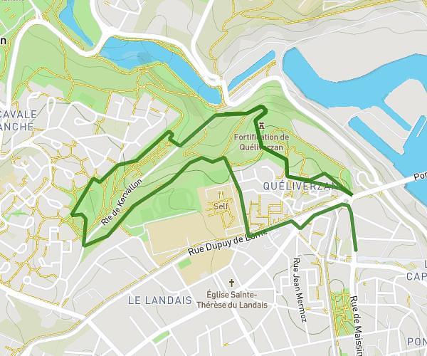
This running route covers 5.052mi starting from Plouzané, Finistère. The run is a loop trail and returns to the trailhead. This run is rated as moderate, expect about 54m to complete it. The route has an elevation gain of 105ft and an elevation loss of 184ft.
Pour le midi
Route details
5.61mph
Speed
617 kcal
Calories burned
Loop trail
Route type
79ft
Min altitude
210ft
Max altitude
Route profile
105ft
Elevation gain
184ft
Elevation loss
79ft
Min altitude
210ft
Max altitude
How to get there
Trailhead: 1130 Avenue Du Technopôle, 29280 Plouzané, France
GPS coordinates of the trailhead: 48.36108, -4.564393 / 48°21'39'' N, 4°33'51'' W