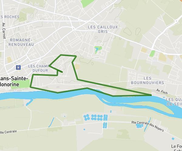
This running route covers 6.001mi starting from Sailly, Yvelines. The run is a loop trail and returns to the trailhead. This run is rated as moderate, expect about 1h to complete it. The route has an elevation gain of 791ft and an elevation loss of 791ft.
10km sailly
Route details
6.0mph
Speed
686 kcal
Calories burned
Loop trail
Route type
285ft
Min altitude
584ft
Max altitude
Route profile
791ft
Elevation gain
791ft
Elevation loss
285ft
Min altitude
584ft
Max altitude
How to get there
Trailhead: Rue De La Montcient, 78440 Sailly
GPS coordinates of the trailhead: 49.0407, 1.80071 / 49°2'26'' N, 1°48'2'' E