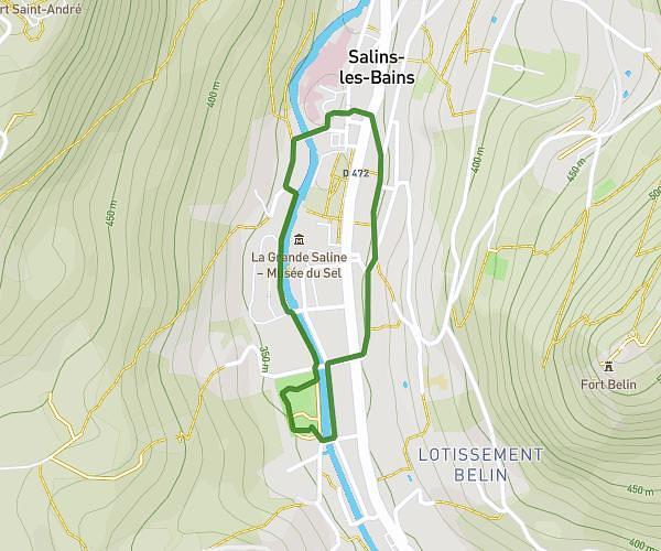
This running route covers 0.841mi starting from Salins-les-Bains, Jura. The run is a loop trail and returns to the trailhead. This run is rated as easy, expect about 9m to complete it. The route has an elevation gain of 13ft and an elevation loss of 30ft.
mineurs
Route details
5.6mph
Speed
103 kcal
Calories burned
Loop trail
Route type
1122ft
Min altitude
1152ft
Max altitude
Route profile
13ft
Elevation gain
30ft
Elevation loss
1122ft
Min altitude
1152ft
Max altitude
How to get there
Trailhead: 4 Faubourg Saint-Nicolas, 39110 Salins-les-Bains, France
GPS coordinates of the trailhead: 46.934695, 5.876397 / 46°56'4'' N, 5°52'35'' E