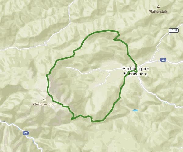
This running route covers 3.162mi starting from Kottingbrunn, Lower Austria. The run is a loop trail and returns to the trailhead. This run is rated as easy, expect about 34m to complete it. The route has an elevation gain of 190ft and an elevation loss of 190ft.
ItBegins
Route details
5.58mph
Speed
389 kcal
Calories burned
Loop trail
Route type
846ft
Min altitude
886ft
Max altitude
Route profile
190ft
Elevation gain
190ft
Elevation loss
846ft
Min altitude
886ft
Max altitude
How to get there
Trailhead: Karl-Haindl-Gasse 3c, 2542 Kottingbrunn, Austria
GPS coordinates of the trailhead: 47.936653, 16.225081 / 47°56'11'' N, 16°13'30'' E