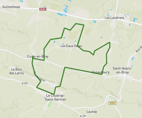
This running route covers 1.89mi starting from Beauvais, Oise. The run is a loop trail and returns to the trailhead. This run is rated as easy, expect about 22m48s to complete it. The route has an elevation gain of 131ft and an elevation loss of 131ft.
Course 3km Marissel
Route details
4.97mph
Speed
261 kcal
Calories burned
Loop trail
Route type
197ft
Min altitude
259ft
Max altitude
Route profile
131ft
Elevation gain
131ft
Elevation loss
197ft
Min altitude
259ft
Max altitude
How to get there
Trailhead: 31 Rue De L'orangerie, 60000 Beauvais, France
GPS coordinates of the trailhead: 49.43095, 2.09388 / 49°25'51'' N, 2°5'37'' E