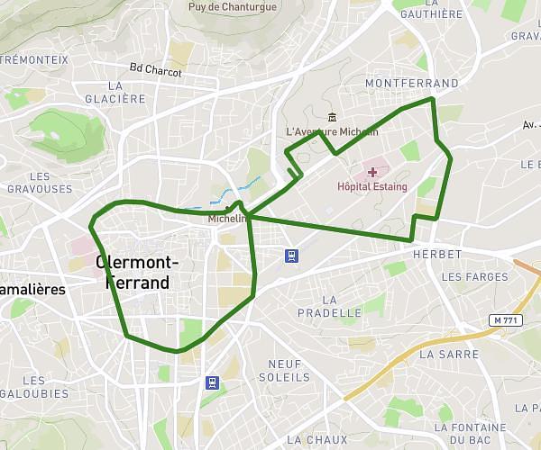
This running route covers 12.15mi starting from Aydat, Puy-de-Dôme. The run is a loop trail and returns to the trailhead. This run is rated as strenuous, expect about 1h57m to complete it. The route has an elevation gain of 509ft and an elevation loss of 489ft.
Aydat
Route details
6.23mph
Speed
1338 kcal
Calories burned
Loop trail
Route type
2822ft
Min altitude
3330ft
Max altitude
Route profile
509ft
Elevation gain
489ft
Elevation loss
2822ft
Min altitude
3330ft
Max altitude
How to get there
Trailhead: 51 Rue De La Vachère, 63970 Aydat, France
GPS coordinates of the trailhead: 45.67851, 2.99803 / 45°40'42'' N, 2°59'52'' E