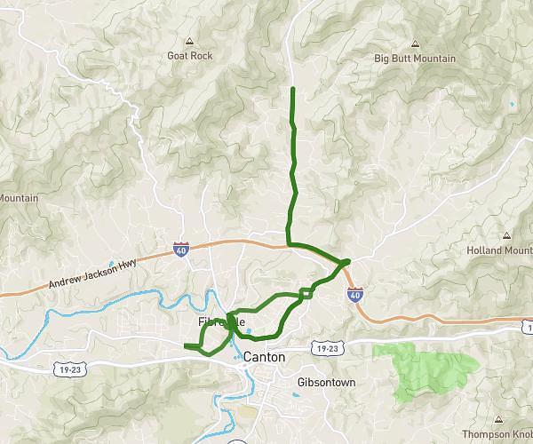
This cycling route covers 14.067mi starting from Canton, North Carolina. The ride is a loop trail and returns to the trailhead. This route is rated as hard, plan for about 1h42s to complete it. The route has an elevation gain of 1421ft and an elevation loss of 1424ft.
Hometown Hardware Ride
Route details
545 kcal
Calories burned
3.8%
Avg grade
Loop trail
Route type
2569ft
Min altitude
2894ft
Max altitude
Route profile
1421ft
Elevation gain
1424ft
Elevation loss
2569ft
Min altitude
2894ft
Max altitude
How to get there
Trailhead: 3611 Beaverdam Road, Canton, North Carolina 28716, United States
GPS coordinates of the trailhead: 35.595239, -82.831054 / 35°35'42'' N, 82°49'51'' W