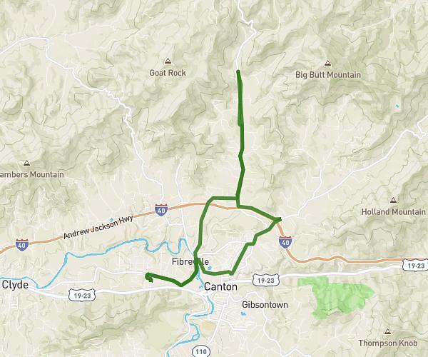
This cycling route covers 16.545mi starting from Canton, North Carolina. The ride is a loop trail and returns to the trailhead. This route is rated as moderate, plan for about 1h20m to complete it. The route has an elevation gain of 367ft and an elevation loss of 374ft.
Skyland Terrace
Route details
704 kcal
Calories burned
0.8%
Avg grade
Loop trail
Route type
2618ft
Min altitude
2779ft
Max altitude
Route profile
367ft
Elevation gain
374ft
Elevation loss
2618ft
Min altitude
2779ft
Max altitude
How to get there
Trailhead: 3142 Beaverdam Road, Canton, North Carolina 28716, United States
GPS coordinates of the trailhead: 35.588339, -82.830011 / 35°35'18'' N, 82°49'48'' W