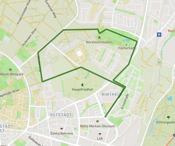
This running route covers 3.979mi starting from Ettlingen, Baden-Württemberg. The run is a loop trail and returns to the trailhead. This run is rated as easy, expect about 43m to complete it. The route has an elevation gain of 16ft and an elevation loss of 13ft.
6.4
Route details
5.56mph
Speed
492 kcal
Calories burned
Loop trail
Route type
377ft
Min altitude
394ft
Max altitude
Route profile
16ft
Elevation gain
13ft
Elevation loss
377ft
Min altitude
394ft
Max altitude
How to get there
Trailhead: Buchenweg 1, 76275 Ettlingen, Germany
GPS coordinates of the trailhead: 48.951754, 8.38399 / 48°57'6'' N, 8°23'2'' E