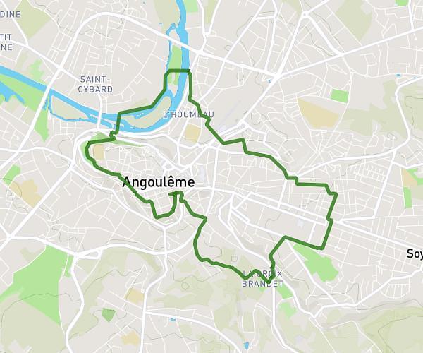
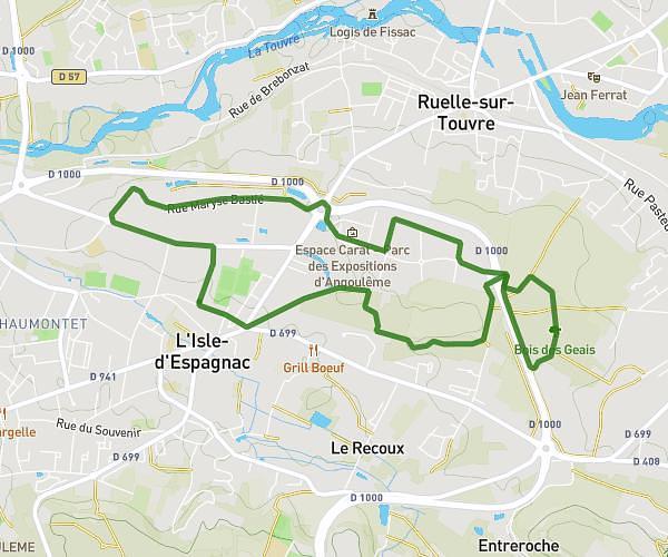
This running route covers 5.873mi starting from Angoulême, Charente. The run is a loop trail and returns to the trailhead. This run is rated as moderate, expect about 1h3m to complete it. The route has an elevation gain of 43ft and an elevation loss of 39ft.
Dimanche aprèm
Route details
5.59mph
Speed
720 kcal
Calories burned
Loop trail
Route type
131ft
Min altitude
171ft
Max altitude
Route profile
43ft
Elevation gain
39ft
Elevation loss
131ft
Min altitude
171ft
Max altitude
How to get there
Trailhead: 152 Rue De Paris, 16000 Angoulême, France
GPS coordinates of the trailhead: 45.654041, 0.160136 / 45°39'14'' N, 0°9'36'' E