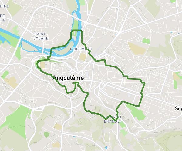
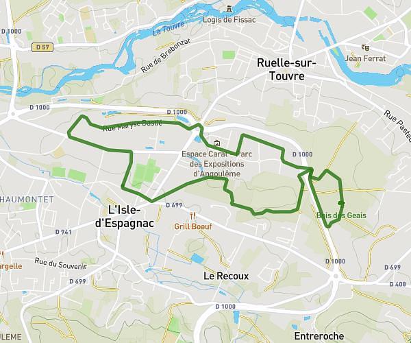
This running route covers 6.203mi starting from Angoulême, Charente. The run does not return to the trailhead and ends near Rue Des Papetiers, 16000 Angoulême, France. This run is rated as moderate, expect about 1h7m to complete it. The route has an elevation gain of 3ft and an elevation loss of 213ft.
10K Angoulême
Route details
5.56mph
Speed
766 kcal
Calories burned
Point to point
Route type
95ft
Min altitude
308ft
Max altitude
Route profile
3ft
Elevation gain
213ft
Elevation loss
95ft
Min altitude
308ft
Max altitude
How to get there
Trailhead: 45 Rue De La Tourgarnier, 16000 Angoulême, France
GPS coordinates of the trailhead: 45.64609, 0.166096 / 45°38'45'' N, 0°9'57'' E