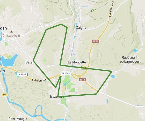
This running route covers 10.189mi starting from Bazeilles, Ardennes. The run is a loop trail and returns to the trailhead. This run is rated as hard, expect about 1h49m to complete it. The route has an elevation gain of 810ft and an elevation loss of 817ft.
Champs de mars
Route details
5.59mph
Speed
1250 kcal
Calories burned
Loop trail
Route type
509ft
Min altitude
791ft
Max altitude
Route profile
810ft
Elevation gain
817ft
Elevation loss
509ft
Min altitude
791ft
Max altitude
How to get there
Trailhead: 15 Avenue Du Docteur Abd El Nour, 08140 Bazeilles, France
GPS coordinates of the trailhead: 49.684036, 4.979977 / 49°41'2'' N, 4°58'47'' E