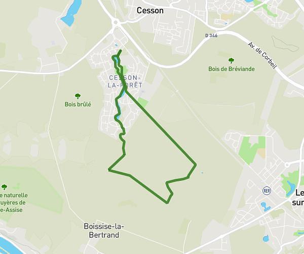
This hiking trail covers 6.487mi starting from Saint-Pierre-du-Perray, Essonne. The hike is a loop trail and returns to the trailhead. This hike is rated as easy, plan for about 2h26m to complete it. The route has an elevation gain of 305ft and an elevation loss of 305ft.
10km parking winnolaland
Route details
2.67mph
Speed
1037 kcal
Calories burned
1.8%
Avg grade
Loop trail
Route type
243ft
Min altitude
318ft
Max altitude
Route profile
305ft
Elevation gain
305ft
Elevation loss
243ft
Min altitude
318ft
Max altitude
How to get there
Trailhead: Route Des Bruyères, 91280 Saint-Pierre-du-Perray, France
GPS coordinates of the trailhead: 48.588572, 2.515963 / 48°35'18'' N, 2°30'57'' E