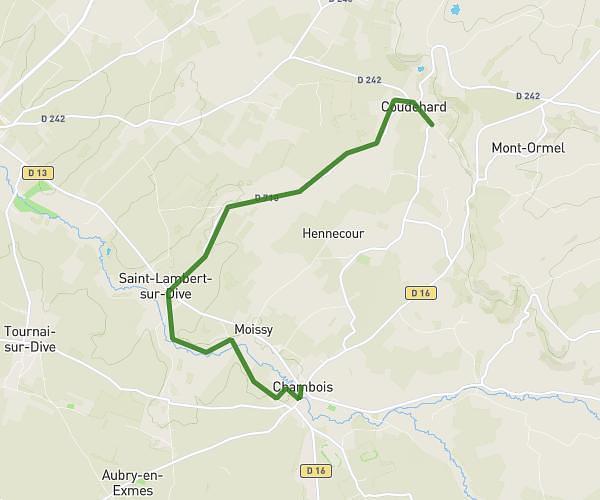
This running route covers 12.414mi starting from Coudehard, Orne. The run is a loop trail and returns to the trailhead. This run is rated as strenuous, expect about 2h to complete it. The route has an elevation gain of 482ft and an elevation loss of 472ft.
Boucle 2 h
Route details
6.21mph
Speed
1372 kcal
Calories burned
Loop trail
Route type
295ft
Min altitude
515ft
Max altitude
Route profile
482ft
Elevation gain
472ft
Elevation loss
295ft
Min altitude
515ft
Max altitude
How to get there
Trailhead: 510 Route De Chambois, 61160 Coudehard, France
GPS coordinates of the trailhead: 48.8432, 0.13316 / 48°50'35'' N, 0°7'59'' E