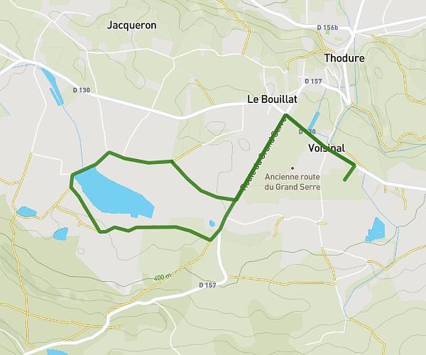
This walking route covers 2.366mi starting from Saint-Christophe-et-le-Laris, Drôme. The walk is a loop trail and returns to the trailhead. This walk is rated as easy, plan for about 51m to complete it. The route has an elevation gain of 253ft and an elevation loss of 249ft.
Parcours 1
Route details
21:33/mi
Pace
208 kcal
Calories burned
Loop trail
Route type
1050ft
Min altitude
1214ft
Max altitude
Route profile
253ft
Elevation gain
249ft
Elevation loss
1050ft
Min altitude
1214ft
Max altitude
How to get there
Trailhead: 432 Route De Miribel, 26350 Saint-Christophe-et-le-Laris, France
GPS coordinates of the trailhead: 45.204015, 5.073893 / 45°12'14'' N, 5°4'26'' E