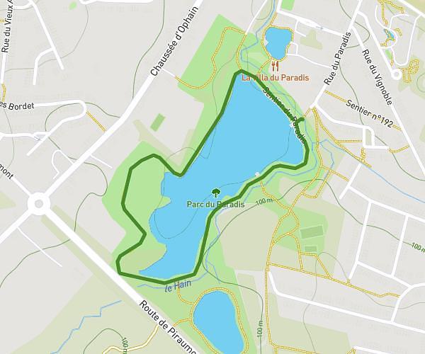
This running route covers 1.553mi starting from Woluwe-Saint-Pierre, Brussels-Capital. The run is a loop trail and returns to the trailhead. This run is rated as easy, expect about 15m19s to complete it. The route has an elevation gain of 112ft and an elevation loss of 108ft.
Corrida WSP
Route details
6.21mph
Speed
175 kcal
Calories burned
Loop trail
Route type
269ft
Min altitude
377ft
Max altitude
Route profile
112ft
Elevation gain
108ft
Elevation loss
269ft
Min altitude
377ft
Max altitude
How to get there
Trailhead: Parvis Sainte-Alix - Sinte-Aleidisvoorplein, 1150 Woluwe-Saint-Pierre
GPS coordinates of the trailhead: 50.82845, 4.46296 / 50°49'42'' N, 4°27'46'' E