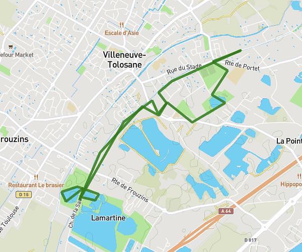
This running route covers 2.562mi starting from Toulouse, Haute-Garonne. The run is a loop trail and returns to the trailhead. This run is rated as easy, expect about 30m55s to complete it. The route has an elevation gain of 125ft and an elevation loss of 125ft.
Gros rectangle Paul Sab
Route details
4.97mph
Speed
353 kcal
Calories burned
Loop trail
Route type
482ft
Min altitude
518ft
Max altitude
Route profile
125ft
Elevation gain
125ft
Elevation loss
482ft
Min altitude
518ft
Max altitude
How to get there
Trailhead: Rue Jacques Farran, 31400 Toulouse, France
GPS coordinates of the trailhead: 43.56781, 1.469083 / 43°34'4'' N, 1°28'8'' E