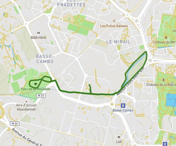
This running route covers 4.651mi starting from Toulouse, Haute-Garonne. The run is a loop trail and returns to the trailhead. This run is rated as easy, expect about 47m37s to complete it. The route has an elevation gain of 10ft and an elevation loss of 13ft.
Reprise
Route details
5.86mph
Speed
544 kcal
Calories burned
Loop trail
Route type
449ft
Min altitude
459ft
Max altitude
Route profile
10ft
Elevation gain
13ft
Elevation loss
449ft
Min altitude
459ft
Max altitude
How to get there
Trailhead: 26 Chemin Des Izards, 31200 Toulouse, France
GPS coordinates of the trailhead: 43.63814, 1.44414 / 43°38'17'' N, 1°26'38'' E