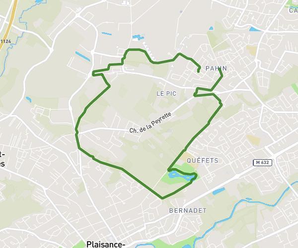
This running route covers 2.5mi starting from Toulouse, Haute-Garonne. The run does not return to the trailhead and ends near 14 Place Intérieure Saint-Cyprien, 31300 Toulouse, France. This run is rated as easy, expect about 27m to complete it. The route has an elevation gain of 200ft and an elevation loss of 207ft.
courses emilie
Route details
5.56mph
Speed
309 kcal
Calories burned
Point to point
Route type
440ft
Min altitude
492ft
Max altitude
Route profile
200ft
Elevation gain
207ft
Elevation loss
440ft
Min altitude
492ft
Max altitude
How to get there
Trailhead: 12 Rue Adolphe Coll, 31300 Toulouse, France
GPS coordinates of the trailhead: 43.598707, 1.42725 / 43°35'55'' N, 1°25'38'' E