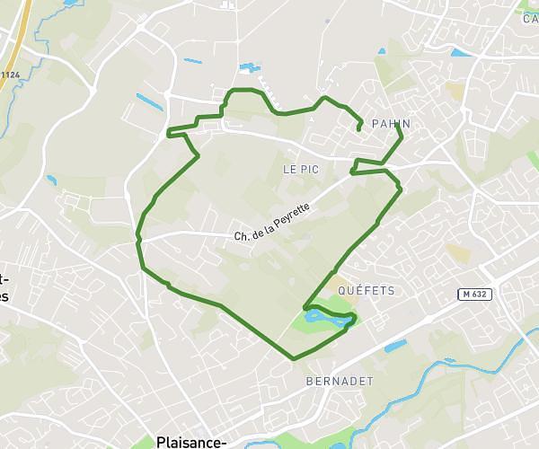
This running route covers 2.399mi starting from Tournefeuille, Haute-Garonne. The run is a loop trail and returns to the trailhead. This run is rated as easy, expect about 33m5s to complete it. The route has an elevation gain of 157ft and an elevation loss of 157ft.
Première course à pied
Route details
4.35mph
Speed
378 kcal
Calories burned
Loop trail
Route type
522ft
Min altitude
623ft
Max altitude
Route profile
157ft
Elevation gain
157ft
Elevation loss
522ft
Min altitude
623ft
Max altitude
How to get there
Trailhead: Résidence Parc Rimbaud, 31170 Tournefeuille, France
GPS coordinates of the trailhead: 43.58323, 1.307565 / 43°34'59'' N, 1°18'27'' E