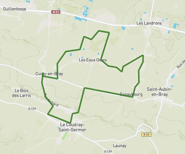
This running route covers 4.834mi starting from Trie-Château, Oise. The run is a loop trail and returns to the trailhead. This run is rated as easy, expect about 52m to complete it. The route has an elevation gain of 118ft and an elevation loss of 105ft.
Itinéraire de Course Trie-Château
Route details
5.58mph
Speed
595 kcal
Calories burned
Loop trail
Route type
194ft
Min altitude
312ft
Max altitude
Route profile
118ft
Elevation gain
105ft
Elevation loss
194ft
Min altitude
312ft
Max altitude
How to get there
Trailhead: 53 Rue Nationale, 60590 Trie-Château, France
GPS coordinates of the trailhead: 49.286128, 1.820305 / 49°17'10'' N, 1°49'13'' E