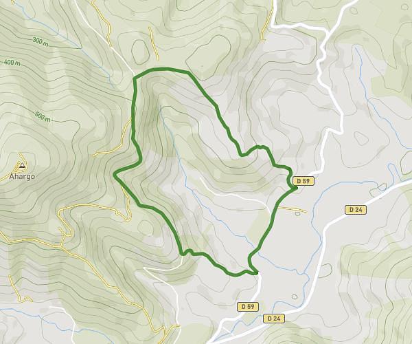
This walking route covers 4.597mi starting from Arbus, Pyrénées-Atlantiques. The walk is a loop trail and returns to the trailhead. This walk is rated as moderate, plan for about 1h28m to complete it. The route has an elevation gain of 538ft and an elevation loss of 548ft.
Boucle bois d'arbus
Route details
19:14/mi
Pace
361 kcal
Calories burned
Loop trail
Route type
417ft
Min altitude
696ft
Max altitude
Route profile
538ft
Elevation gain
548ft
Elevation loss
417ft
Min altitude
696ft
Max altitude
How to get there
Trailhead: 2 Rue Du Château D'abos, 64230 Arbus, France
GPS coordinates of the trailhead: 43.33821, -0.51994 / 43°20'17'' N, 0°31'11'' W