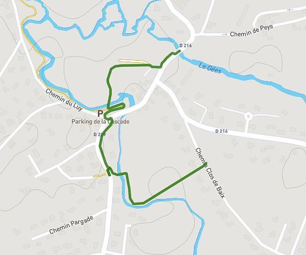
This walking route covers 3.698mi starting from Pau, Pyrénées-Atlantiques. The walk is a loop trail and returns to the trailhead. This walk is rated as moderate, plan for about 45m to complete it. The route has an elevation gain of 115ft and an elevation loss of 128ft.
PP45
Route details
12:10/mi
Pace
184 kcal
Calories burned
Loop trail
Route type
689ft
Min altitude
755ft
Max altitude
Route profile
115ft
Elevation gain
128ft
Elevation loss
689ft
Min altitude
755ft
Max altitude
How to get there
Trailhead: Rue René Marie Castaing, 64000 Pau, France
GPS coordinates of the trailhead: 43.30554, -0.36548 / 43°18'19'' N, 0°21'55'' W