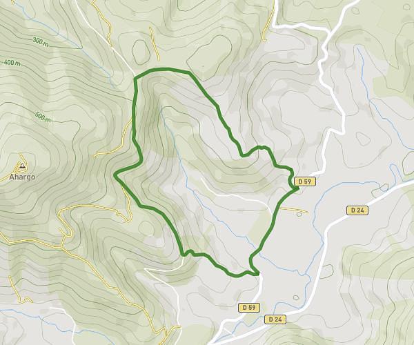
This walking route covers 11.275mi starting from Lacommande, Pyrénées-Atlantiques. The walk is a loop trail and returns to the trailhead. This walk is rated as strenuous, plan for about 2h20m to complete it. The route has an elevation gain of 1791ft and an elevation loss of 1781ft.
Boucle lacommande
Route details
12:26/mi
Pace
572 kcal
Calories burned
Loop trail
Route type
512ft
Min altitude
1102ft
Max altitude
Route profile
1791ft
Elevation gain
1781ft
Elevation loss
512ft
Min altitude
1102ft
Max altitude
How to get there
Trailhead: 41 Route De Lasseube, 64360 Lacommande, France
GPS coordinates of the trailhead: 43.27732, -0.5076 / 43°16'38'' N, 0°30'27'' W