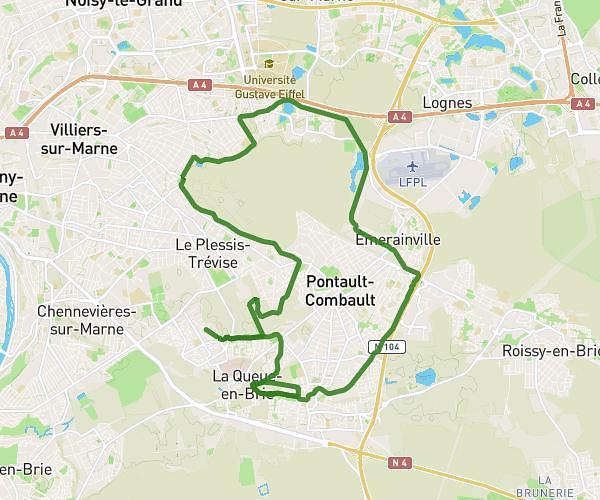
This running route covers 4.115mi starting from Saint-Maur-des-Fossés, Val-de-Marne. The run is a loop trail and returns to the trailhead. This run is rated as easy, expect about 1h to complete it. The route has an elevation gain of 289ft and an elevation loss of 289ft.
test
Route details
4.11mph
Speed
686 kcal
Calories burned
Loop trail
Route type
118ft
Min altitude
197ft
Max altitude
Route profile
289ft
Elevation gain
289ft
Elevation loss
118ft
Min altitude
197ft
Max altitude
How to get there
Trailhead: Avenue Gallieni, 94100 Saint-Maur-des-Fossés
GPS coordinates of the trailhead: 48.80932, 2.4736 / 48°48'33'' N, 2°28'24'' E