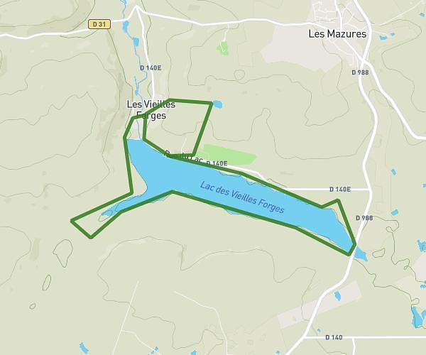
This cycling route covers 12.903mi starting from Les Mazures, Ardennes. The ride does not return to the trailhead and ends near 2 Rue Du Lac, 08500 Les Mazures, France. This route is rated as easy, plan for about 2h5m to complete it. The route has an elevation gain of 75ft and an elevation loss of 79ft.
Parcours 13 (Vielles Forges - 2x tour du lac)
Route details
1095 kcal
Calories burned
0.2%
Avg grade
Point to point
Route type
801ft
Min altitude
840ft
Max altitude
Route profile
75ft
Elevation gain
79ft
Elevation loss
801ft
Min altitude
840ft
Max altitude
How to get there
Trailhead: 19 Rue Du Lac, 08500 Les Mazures, France
GPS coordinates of the trailhead: 49.87829, 4.58993 / 49°52'41'' N, 4°35'23'' E