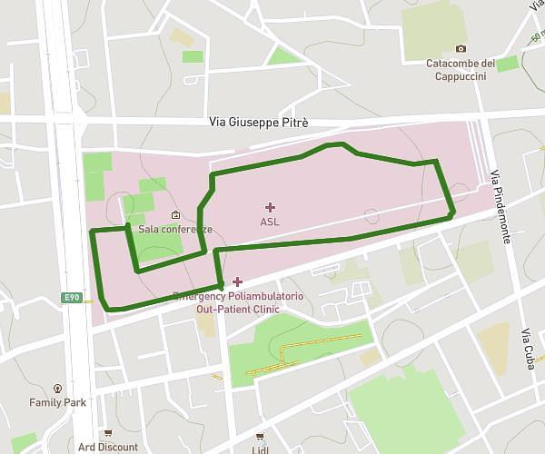
This running route covers 1.463mi starting from Palermo, Palermo. The run is a loop trail and returns to the trailhead. This run is rated as easy, expect about 16m to complete it. The route has an elevation gain of 95ft and an elevation loss of 89ft.
Via la loggia ospedale
Route details
5.49mph
Speed
183 kcal
Calories burned
Loop trail
Route type
180ft
Min altitude
249ft
Max altitude
Route profile
95ft
Elevation gain
89ft
Elevation loss
180ft
Min altitude
249ft
Max altitude
How to get there
Trailhead: Via Gaetano La Loggia 168, 90129 Palermo Palermo, Italy
GPS coordinates of the trailhead: 38.107281, 13.333614 / 38°6'26'' N, 13°20'1'' E