MapPlanner
1.944mi
Distance
41m59s
Duration
21:36/mi
Pace
Easy
Level

trabajo ef

Route details

2.78mph
Speed
480 kcal
Calories burned
Loop trail
Route type
79ft
Min altitude
180ft
Max altitude

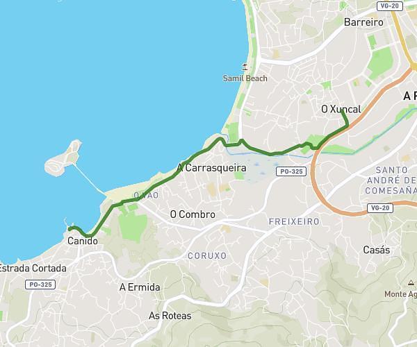
This running route covers 1.944mi starting from Vigo, Pontevedra. The run is a loop trail and returns to the trailhead. This run is rated as easy, expect about 41m59s to complete it. The route has an elevation gain of 92ft and an elevation loss of 102ft.

Route profile

92ft
Elevation gain
102ft
Elevation loss
79ft
Min altitude
180ft
Max altitude

How to get there

Trailhead: Rúa De Caldas De Reis, 36209 Vigo

GPS coordinates of the trailhead: 42.21645, -8.7491 / 42°12'59'' N, 8°44'56'' W

Caution: May Cross Private Property

This route may pass through or near private property. Always respect posted signs, obtain permission where required, and follow local trespassing laws. MapPlanner does not guarantee public access along any route.

Safety Notice

Trail and road conditions may change without notice due to weather, construction, or other factors. Always verify current conditions before heading out. You are responsible for your own safety — follow local signage, obey traffic laws, and use your best judgment on the trail.