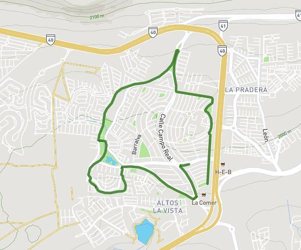
This running route covers 3.911mi starting from Querétaro, Querétaro. The run is a loop trail and returns to the trailhead. This run is rated as easy, expect about 35m to complete it. The route has an elevation gain of 279ft and an elevation loss of 279ft.
El Refugio 1
Route details
6.7mph
Speed
400 kcal
Calories burned
Loop trail
Route type
6493ft
Min altitude
6709ft
Max altitude
Route profile
279ft
Elevation gain
279ft
Elevation loss
6493ft
Min altitude
6709ft
Max altitude
How to get there
Trailhead: Calle Peña De Bernal, 76146 Querétaro, Querétaro, Mexico
GPS coordinates of the trailhead: 20.64602, -100.35682 / 20°38'45'' N, 100°21'24'' W