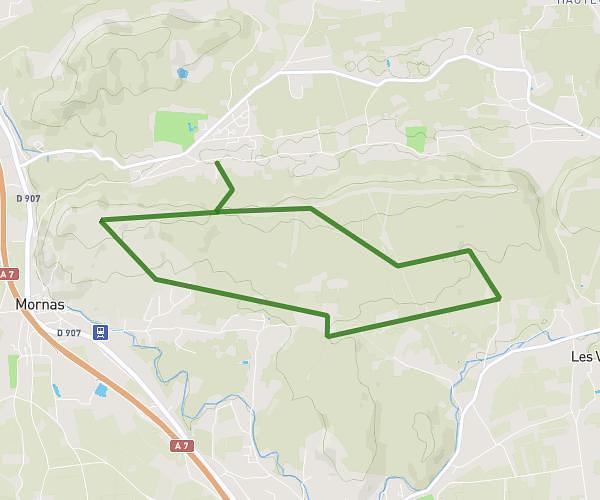
This hiking trail covers 8.381mi starting from Mornas, Vaucluse. The hike is a loop trail and returns to the trailhead. This hike is rated as moderate, plan for about 3h22m to complete it. The route has an elevation gain of 984ft and an elevation loss of 958ft.
Mornas uchaux
Route details
2.49mph
Speed
1469 kcal
Calories burned
4.4%
Avg grade
Loop trail
Route type
217ft
Min altitude
551ft
Max altitude
Route profile
984ft
Elevation gain
958ft
Elevation loss
217ft
Min altitude
551ft
Max altitude
How to get there
Trailhead: 320c Chemin De Mérindol, 84550 Mornas, France
GPS coordinates of the trailhead: 44.212886, 4.749047 / 44°12'46'' N, 4°44'56'' E