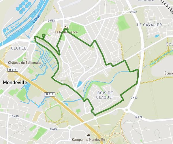
This walking route covers 5.876mi starting from Ranville, Calvados. The walk is a loop trail and returns to the trailhead. This walk is rated as hard, plan for about 2h6m to complete it. The route has an elevation gain of 299ft and an elevation loss of 299ft.
Amfreville
Route details
21:27/mi
Pace
515 kcal
Calories burned
Loop trail
Route type
49ft
Min altitude
194ft
Max altitude
Route profile
299ft
Elevation gain
299ft
Elevation loss
49ft
Min altitude
194ft
Max altitude
How to get there
Trailhead: 30 Rue De Motten, 14860 Ranville, France
GPS coordinates of the trailhead: 49.235103, -0.253813 / 49°14'6'' N, 0°15'13'' W