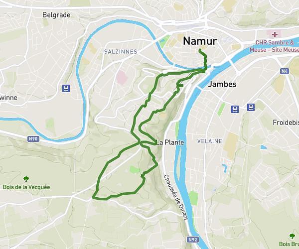
This running route covers 3.745mi starting from Namur, Namur. The run is a loop trail and returns to the trailhead. This run is rated as easy, expect about 44m48s to complete it. The route has an elevation gain of 233ft and an elevation loss of 233ft.
entraînement
Route details
5.01mph
Speed
512 kcal
Calories burned
Loop trail
Route type
233ft
Min altitude
282ft
Max altitude
Route profile
233ft
Elevation gain
233ft
Elevation loss
233ft
Min altitude
282ft
Max altitude
How to get there
Trailhead: Quai Des Chasseurs Ardennais, 5012 Namur, Namur, Belgium
GPS coordinates of the trailhead: 50.46115, 4.86919 / 50°27'40'' N, 4°52'9'' E