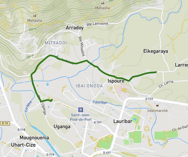
This running route covers 4.023mi starting from Saint-Jean-Pied-de-Port, Pyrénées-Atlantiques. The run is a loop trail and returns to the trailhead. This run is rated as easy, expect about 57m to complete it. The route has an elevation gain of 312ft and an elevation loss of 312ft.
19 avril
Route details
4.24mph
Speed
652 kcal
Calories burned
Loop trail
Route type
499ft
Min altitude
604ft
Max altitude
Route profile
312ft
Elevation gain
312ft
Elevation loss
499ft
Min altitude
604ft
Max altitude
How to get there
Trailhead: 2bis Chemin D'ugange, 64220 Saint-Jean-Pied-de-Port, France
GPS coordinates of the trailhead: 43.164627, -1.238823 / 43°9'52'' N, 1°14'19'' W