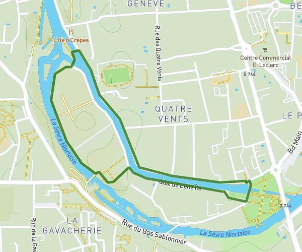
This running route covers 3.69mi starting from Épannes, Deux-Sèvres. The run is a loop trail and returns to the trailhead. This run is rated as easy, expect about 39m35s to complete it. The route has an elevation gain of 16ft and an elevation loss of 20ft.
plan d'eau epannes
Route details
5.59mph
Speed
453 kcal
Calories burned
Loop trail
Route type
59ft
Min altitude
69ft
Max altitude
Route profile
16ft
Elevation gain
20ft
Elevation loss
59ft
Min altitude
69ft
Max altitude
How to get there
Trailhead: Chemin Des Paturelles, 79270 Épannes, France
GPS coordinates of the trailhead: 46.22932, -0.56885 / 46°13'45'' N, 0°34'7'' W