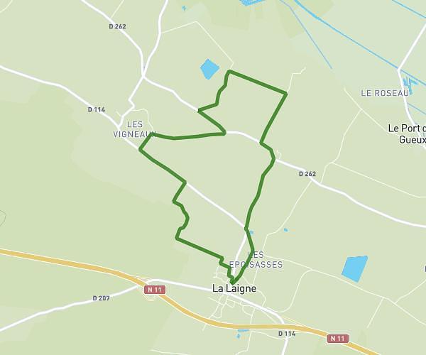
This running route covers 3.732mi starting from Sansais, Deux-Sèvres. The run is a loop trail and returns to the trailhead. This run is rated as easy, expect about 36m to complete it. The route has an elevation gain of 23ft and an elevation loss of 30ft.
Monique
Route details
6.22mph
Speed
412 kcal
Calories burned
Loop trail
Route type
7ft
Min altitude
36ft
Max altitude
Route profile
23ft
Elevation gain
30ft
Elevation loss
7ft
Min altitude
36ft
Max altitude
How to get there
Trailhead: 80 Rue Des Gravées, 79270 Sansais, France
GPS coordinates of the trailhead: 46.30431, -0.59439 / 46°18'15'' N, 0°35'39'' W