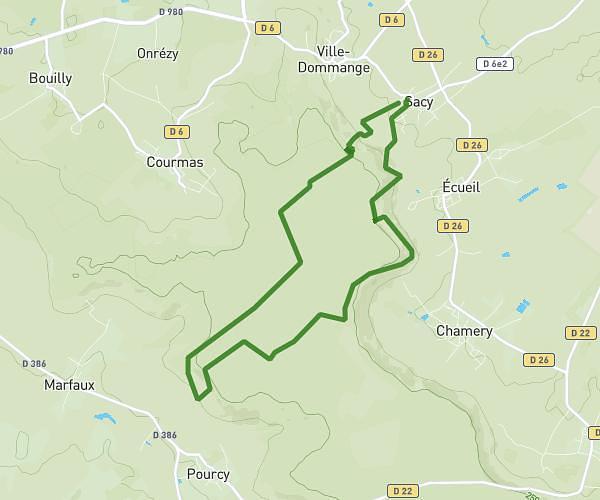
This hiking trail covers 6.625mi starting from Villers-Allerand, Marne. The hike is a loop trail and returns to the trailhead. This hike is rated as moderate, plan for about 1h56m to complete it. The route has an elevation gain of 735ft and an elevation loss of 738ft.
Rando cavam 10 km
Route details
3.42mph
Speed
843 kcal
Calories burned
4.2%
Avg grade
Loop trail
Route type
512ft
Min altitude
925ft
Max altitude
Route profile
735ft
Elevation gain
738ft
Elevation loss
512ft
Min altitude
925ft
Max altitude
How to get there
Trailhead: 3 Rue Du Plat Pain, 51500 Villers-Allerand, France
GPS coordinates of the trailhead: 49.16632, 4.02409 / 49°9'58'' N, 4°1'26'' E