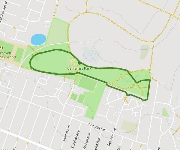
This running route covers 1.993mi starting from Brighton, England. The run does not return to the trailhead and ends near Bevendean Crescent, BN2 4RD Brighton. This run is rated as easy, expect about 2h11s to complete it. The route has an elevation gain of 335ft and an elevation loss of 308ft.
Bevendean Parkrun
Route details
0.99mph
Speed
1374 kcal
Calories burned
Point to point
Route type
226ft
Min altitude
489ft
Max altitude
Route profile
335ft
Elevation gain
308ft
Elevation loss
226ft
Min altitude
489ft
Max altitude
How to get there
Trailhead: Norwich Drive, BN2 4LA Brighton
GPS coordinates of the trailhead: 50.84368, -0.1014 / 50°50'37'' N, 0°6'5'' W