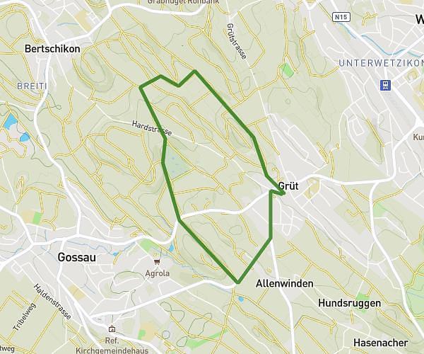
This running route covers 2.876mi starting from Grüt, Zürich. The run is a loop trail and returns to the trailhead. This run is rated as easy, expect about 30m51s to complete it. The route has an elevation gain of 407ft and an elevation loss of 413ft.
Joggingroute
Route details
5.59mph
Speed
353 kcal
Calories burned
Loop trail
Route type
1673ft
Min altitude
1837ft
Max altitude
Route profile
407ft
Elevation gain
413ft
Elevation loss
1673ft
Min altitude
1837ft
Max altitude
How to get there
Trailhead: Pumertweg 3, 8624 Grüt, Switzerland
GPS coordinates of the trailhead: 47.310486, 8.78174 / 47°18'37'' N, 8°46'54'' E